Fontana Dam is 480 feet of concrete across the Little Tennessee River, the tallest dam in the eastern United States and, when it was finished in 1944, the fourth tallest dam in the world. The Tennessee Valley Authority built it in under three years, on a wartime schedule, in a gorge so remote that the government had to build a town before it could build the dam.
From Lake Santeetlah it is about a 45-minute drive east through Robbinsville and up NC-28. It makes a good day trip paired with Fontana Village, the workers' town that never quite went away.
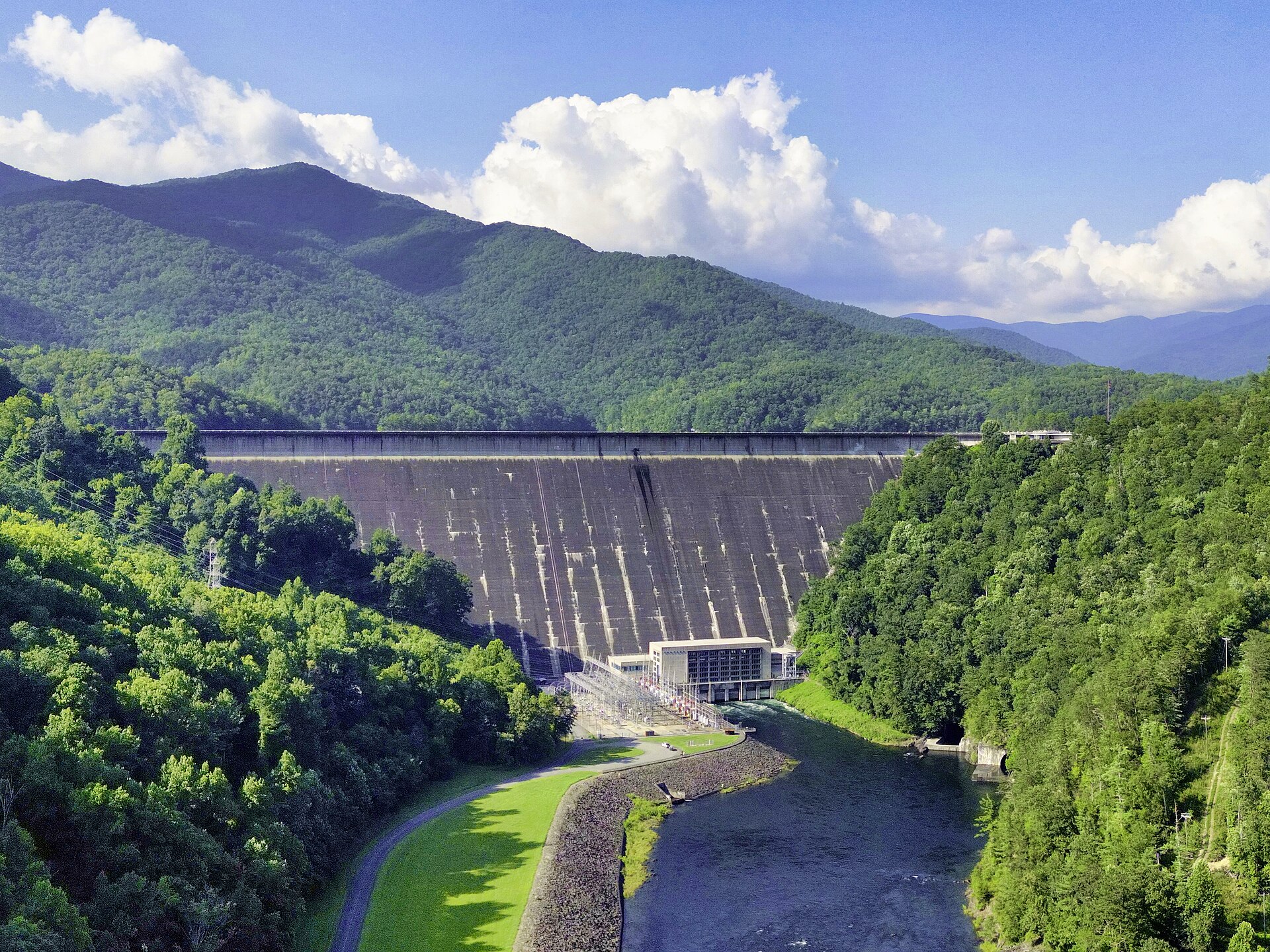
The numbers
- Height: 480 feet
- Length: 2,365 feet across the crest
- Concrete: 2.8 million cubic yards
- Cost: about $70 million
- Power: three generators, rated at 241 megawatts
- Fontana Lake: 10,230 acres, 29 miles long, with roughly 240 miles of shoreline
Congress funded the dam on December 17, 1941, ten days after Pearl Harbor, and construction began on January 1, 1942. The point was electricity, fast: the Alcoa aluminum plants across the line in Tennessee needed power to make metal for warplanes, and a rural corner of North Carolina and Tennessee needed power, period. Crews worked three shifts, around the clock, under floodlights. The reservoir began filling in November 1944, and the first generators came online on January 20, 1945, in time to feed aluminum production in the last months of the war.
The engineering was not routine either. TVA's designers worried that a mass of concrete this size would trap the heat of its own curing for years and crack, so they built the dam in sections fitted with cooling coils and grout pipes. The spillway was its own problem: a 400-foot drop straight down the face threatened to erode the foundation, so the dam releases floodwater through two 34-foot-diameter pipes into a tunnel with a deflection system instead. The dam and its associated structures were listed on the National Register of Historic Places in 2017.
What the lake covered
Fontana Lake is named for a town that no longer exists. Fontana was a lumber and copper-mining town at the mouth of Eagle Creek; the name came from the Italian word for fountain. TVA bought 68,292 acres for the project. Some 1,311 families had to move, more than a thousand graves were relocated, and the towns of Fontana, Bushnell, Forney, and Judson went under the water.
That history is still part of a visit. The lake's north shore is Great Smoky Mountains National Park, and creeks like Hazel Creek and Eagle Creek, reachable only by boat or a long walk, lead to the remains of the communities that were there before the dam. From the water, Fontana looks empty. It was not always.
The town the dam built
The dam site had nothing: no town, no rail line, no housing. TVA built a railroad to haul supplies and built a village in Welch Cove, south of the dam, to house the workforce. By 1943 more than 5,000 people lived there, which made it, for a time, the largest community in North Carolina west of Asheville. The village had schools, churches, stores, a theater, a hospital, and its own post office. The cafeteria served more than 6,000 meals a day.
When the dam was finished in 1945, the workers left and the village stayed. Within two years it had been converted into a resort, and it operates today as Fontana Village Resort. A number of the cabins guests sleep in are the original workers' houses. The town of Fontana Dam around it was not incorporated until 2011 and has only a handful of full-time residents.
Walking the dam
You can walk across the top of the dam, and people do it as part of a much longer walk: the Appalachian Trail crosses the crest and heads into the national park. The shelter just below the dam, maintained with help from TVA, has hot showers, which is why thru-hikers call it the Fontana Hilton. TVA runs a visitor center at the dam, open daily from May through October, and there is parking both on top of the dam and below it.
From Lake Santeetlah
The drive from the lake runs through Robbinsville, then east on NC-143 and NC-28, the road riders know as the Moonshiner 28. It is about 30 miles and 45 minutes from 4 Lakeside Trail to the visitor center parking. Go in the morning, walk the dam, look at the powerhouse 480 feet below, then stop in Fontana Village for lunch and drive the rest of the Moonshiner 28 toward Bryson City if you want to make a full day of it.
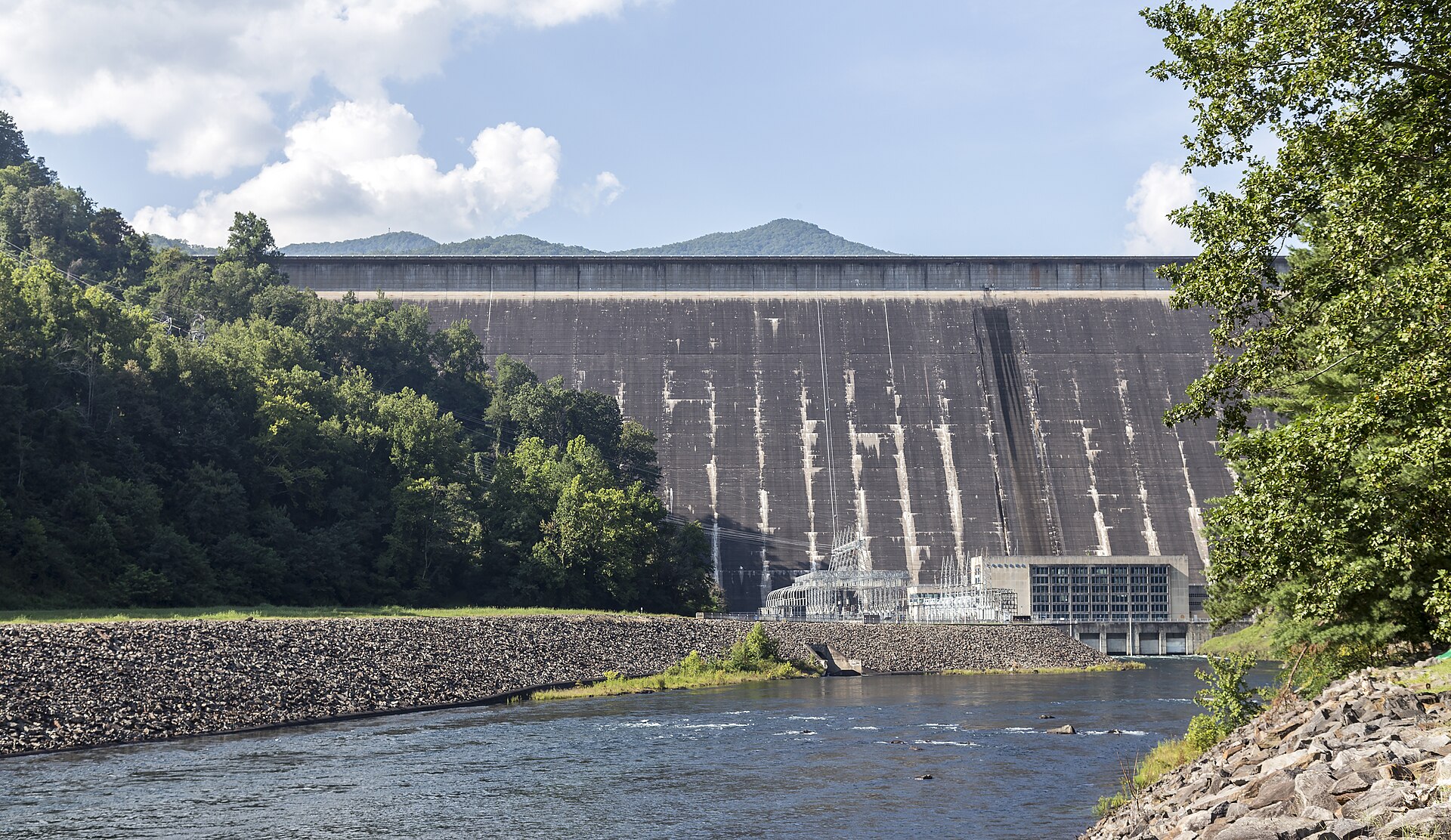
Two dams, two eras
| Fontana Dam | Santeetlah Dam | |
|---|---|---|
| Height | 480 ft | a little over 200 ft |
| Crest length | 2,365 ft | 1,054 ft |
| Reservoir | 10,230 acres | 2,881 acres |
| River dammed | Little Tennessee | Cheoah |
| Built by | TVA, 1942–45 | Alcoa (Tapoco), 1925–28 |
Santeetlah Dam was listed on the National Register of Historic Places in 2004; the Appalachian Trail crosses Fontana Dam's crest.
Keep reading
- A Smoky Mountains Day Trip from Robbinsville: Oconaluftee, Newfound Gap, and Kuwohi
- How Lake Santeetlah Was Made: The 1928 Dam on the Cheoah River
- The Nantahala River: Rafting the Gorge, the NOC, and 50-Degree Water
Common questions
How tall is Fontana Dam?
480 feet, making it the tallest dam in the eastern United States. It is 2,365 feet long and contains 2.8 million cubic yards of concrete.
Can you walk across Fontana Dam?
Yes. The road across the crest is open to pedestrians, and the Appalachian Trail follows it before entering Great Smoky Mountains National Park. Parking is available on top of the dam and below it.
How far is Fontana Dam from Lake Santeetlah?
About 30 miles, roughly 45 minutes by car, via US-129 to Robbinsville and then NC-143 and NC-28 east.