The Nantahala River takes its name from a Cherokee phrase usually translated as "land of the noonday sun." The gorge it cuts is deep enough that direct sunlight reaches the water only around midday. For paddlers, the name matters less than two facts: the river runs on a dam schedule, so it has water all season, and the water comes off the bottom of a mountain lake, so it is cold in January and just as cold in July.
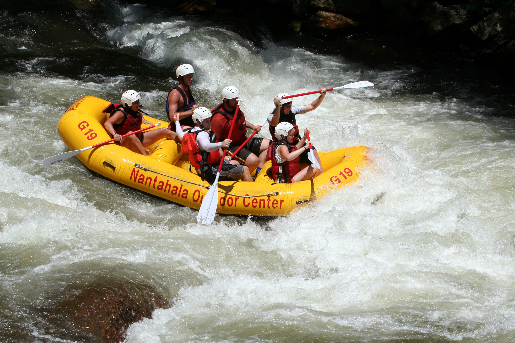
The commercial rafting run is 8 miles of Class II and III whitewater through the Nantahala Gorge, from the powerhouse at the top to the village of Wesser at the bottom. It is about a 45-minute drive from Lake Santeetlah, and it is the biggest day-trip draw in this part of the mountains.
Why the water is always cold
The Nantahala is a diverted river. Duke Energy's dam on Nantahala Lake sends the river through a 5.5-mile underground penstock to a powerhouse far downstream, where it rejoins the channel. The intake sits near the bottom of the lake, so the discharged water comes out at close to groundwater temperature: in the low 50s, Fahrenheit, year-round. On a 90-degree August afternoon the river is still in the low 50s. Outfitters hand out wetsuits and splash gear for a reason, and the cold is part of the deal rather than a surprise.
Because the flow depends on power generation, the river is either on or off. From late spring to early fall, Duke Energy follows a regular release schedule built to support commercial rafting, so in season the water is dependable. Check the release schedule before driving over, especially at the edges of the season.
The run: powerhouse to Wesser
Trips start below the powerhouse and open with Patton's Run, then settle into a rhythm of named Class II rapids: Quarry, Whirlpool, Surfers, Bulls Run. The gorge walls close in, US-19/74 runs along the bank, and the current stays busy without getting serious. The one Class III rapid, Nantahala Falls, comes at the very end, just above the take-out at Wesser. Twelve commercial outfitters are permitted by the Forest Service to run trips on this section, so on a summer Saturday the river is busy; on a weekday it is considerably calmer.
The NOC
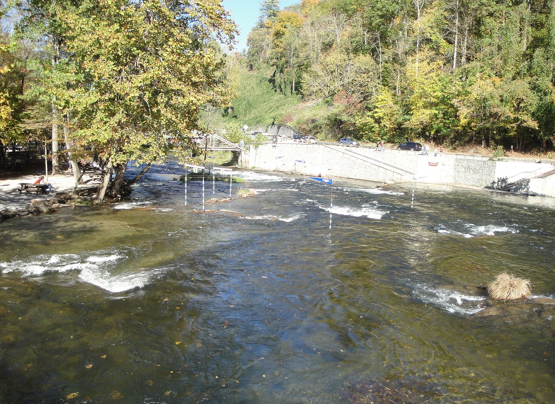
The take-out at Wesser is the front yard of the Nantahala Outdoor Center. The NOC was founded in 1972 by Payson and Aurelia Kennedy and Horace Holden, Sr., who took over a small roadside motel called the Tote 'n Tarry and started running rafts. In its first season it put 800 guests on the Nantahala. It now occupies a 500-acre campus with restaurants, lodging, shops, and zip lines, and the Appalachian Trail passes through on its way between Fontana Dam and the Smokies.
The NOC also became the center of American paddlesport. More than 30 Olympic athletes and world champions have worked or trained there, and in 2013 the campus hosted the ICF Canoe Freestyle World Championships. For a non-paddler, the Great Smoky Mountains Railroad's Nantahala Gorge excursion from Bryson City ends at the NOC with an hour's layover by the river, which is a civilized way to watch other people get wet.
The other river: fishing the upper Nantahala
Above the powerhouse, the Nantahala is a different piece of water entirely, a trout stream running low and clear because most of the river is off in the penstock. The stretch from Whiteoak Creek down to the powerhouse discharge canal is managed under North Carolina's Delayed Harvest rules: heavily stocked (the state puts roughly 10,000 brown, rainbow, and brook trout a year into the upper river), catch-and-release with artificial flies and lures only during the cool months. Below the powerhouse, the tailwater holds one of the state's healthiest populations of wild, stream-born rainbow trout plus self-sustaining browns. The North Carolina state record brown trout, 24 pounds 10 ounces, came out of the Lower Nantahala in 1998.
From Lake Santeetlah
From 4 Lakeside Trail and the lake, drive US-129 south to Robbinsville, then take NC-28 and US-19/74 east into the gorge, about 45 minutes total. Book rafting ahead in summer, wear the wetsuit they offer even if the day is hot, and if anyone in the group would rather angle than paddle, the upper river's delayed-harvest trout water is reached from Wayah Road on the way to the powerhouse. Lake fishing is a separate subject, covered in our guide to fishing Lake Santeetlah.
Keep reading
- Cheoah River Release Days: Class IV-V Whitewater Below Santeetlah Dam
- Fontana Dam and Lake: 480 Feet, the Tallest Dam in the Eastern U.S.
- 48 Hours at Lake Santeetlah: A Weekend Itinerary
Common questions
How cold is the Nantahala River?
In the low 50s Fahrenheit, all year. The water is drawn from the bottom of Nantahala Lake and travels through an underground penstock, so summer heat never reaches it.
What class are the rapids on the Nantahala?
Mostly Class II, with one Class III rapid, Nantahala Falls, at the end of the 8-mile run from the powerhouse to Wesser.
When does the Nantahala River run?
When Duke Energy is generating power at the Nantahala powerhouse. From late spring to early fall, releases follow a regular schedule set to support rafting; check the schedule before you go.